🔍
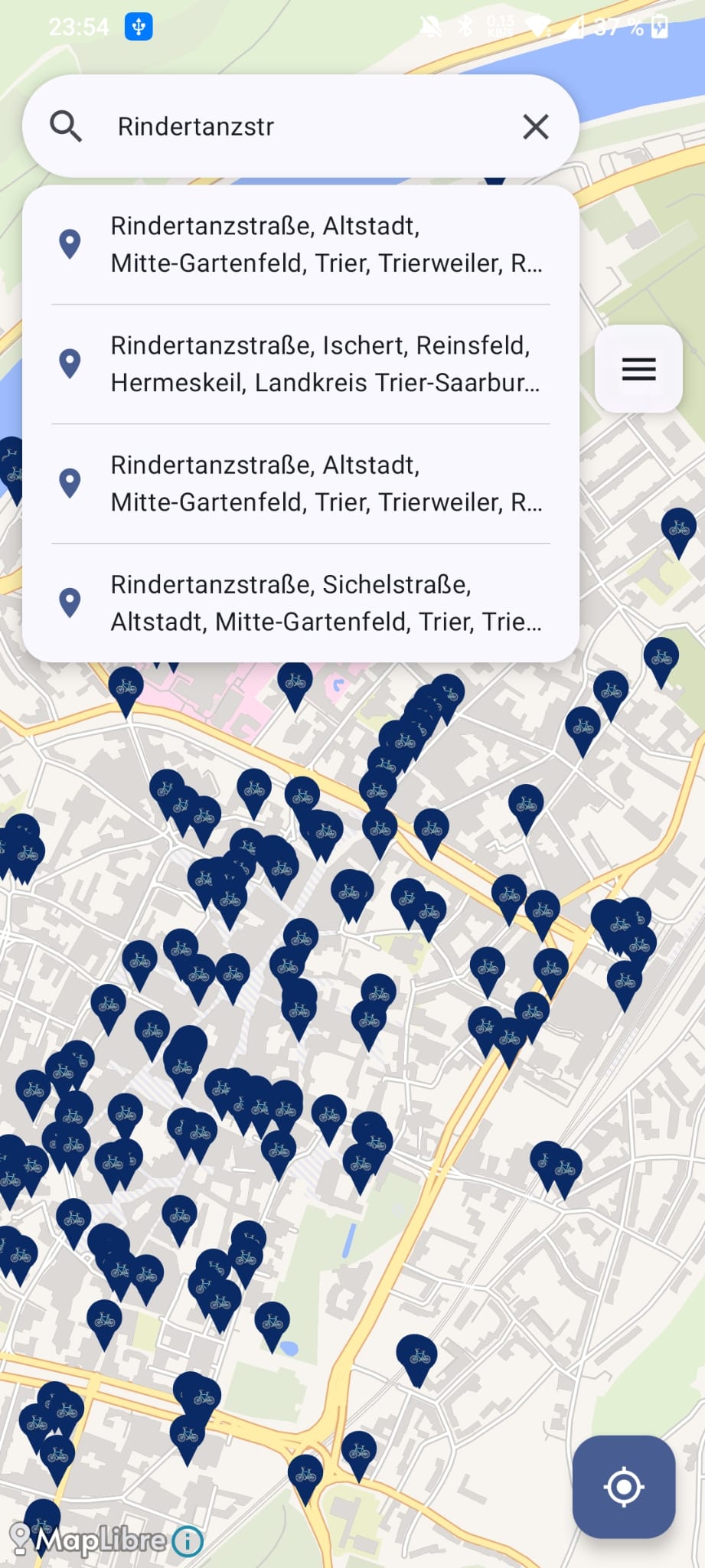
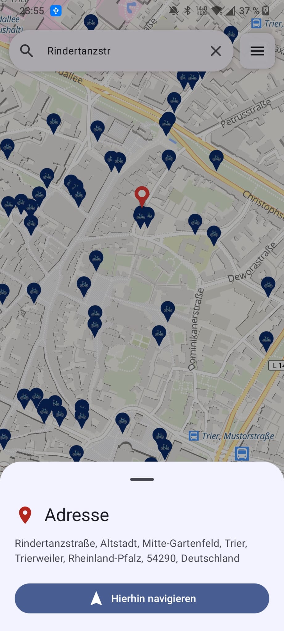
Address Search
Type any address in Germany, France or Luxembourg into the floating search bar to get up to 5 live Nominatim suggestions, biased to your surroundings. Tap a result to drop a pin and open the same sheet as a custom pin — start in-app BRouter navigation, save it as a favourite, or remove the pin.
📌
Tap-to-Place Custom Pin
Tap any empty spot on the map to drop a blue custom pin. The address is resolved instantly via Nominatim reverse geocoding and a bottom sheet lets you start in-app bike navigation directly to that exact location.
🌍
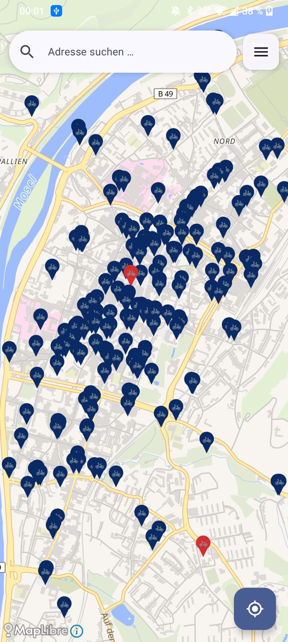
Germany, France & Luxembourg
100 000+ bicycle parking locations from OpenStreetMap — pre-bundled as SQLite assets, available offline from the very first launch.
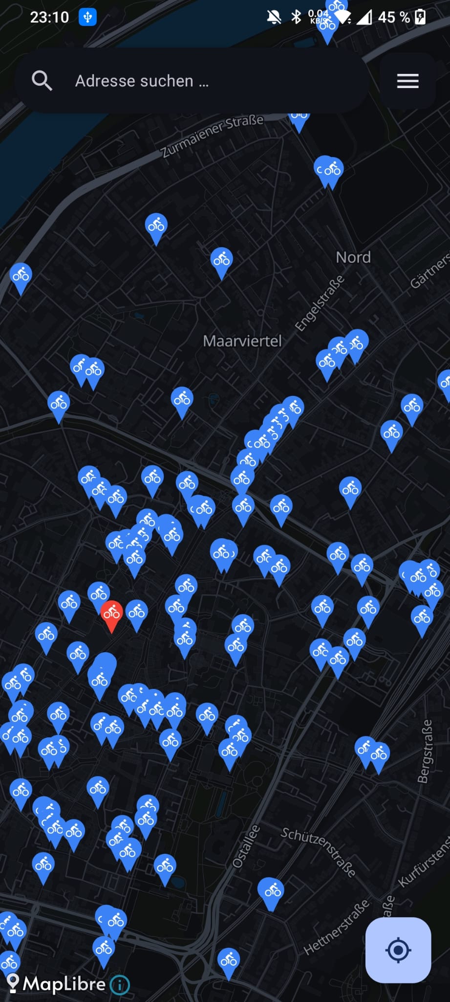
⚡
Viewport-Based Loading
Only the markers visible in the current map area are queried. Scroll from Flensburg to Munich without any slowdowns.
🧊
Marker Clustering
At city-level zoom, dense parking pins are aggregated into native MapLibre clusters for a fast, uncluttered map. Tap a cluster to zoom in and break it apart.
🏠
Fully Offline
All parking data is bundled inside the APK. No network call is needed to find and browse parking spots.
📬
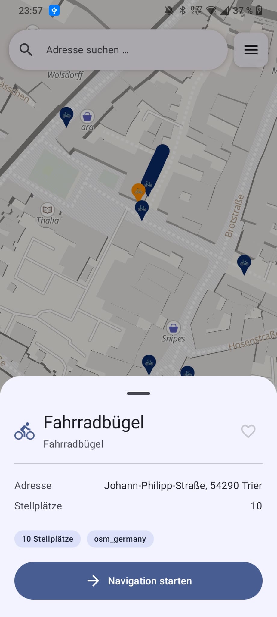
Lazy Address Lookup
Tap a marker and its address is resolved automatically via Nominatim — cached permanently so subsequent opens are instant.
🗾
MapLibre Vector Map
Silky-smooth vector tile rendering via MapLibre and OpenFreeMap Liberty style — no API key needed, sharp at every zoom level, and ready for custom dark-mode styles.
📍
Interactive Map
Browse bike parking spaces on an intuitive vector map with clear markers and quick detail access.
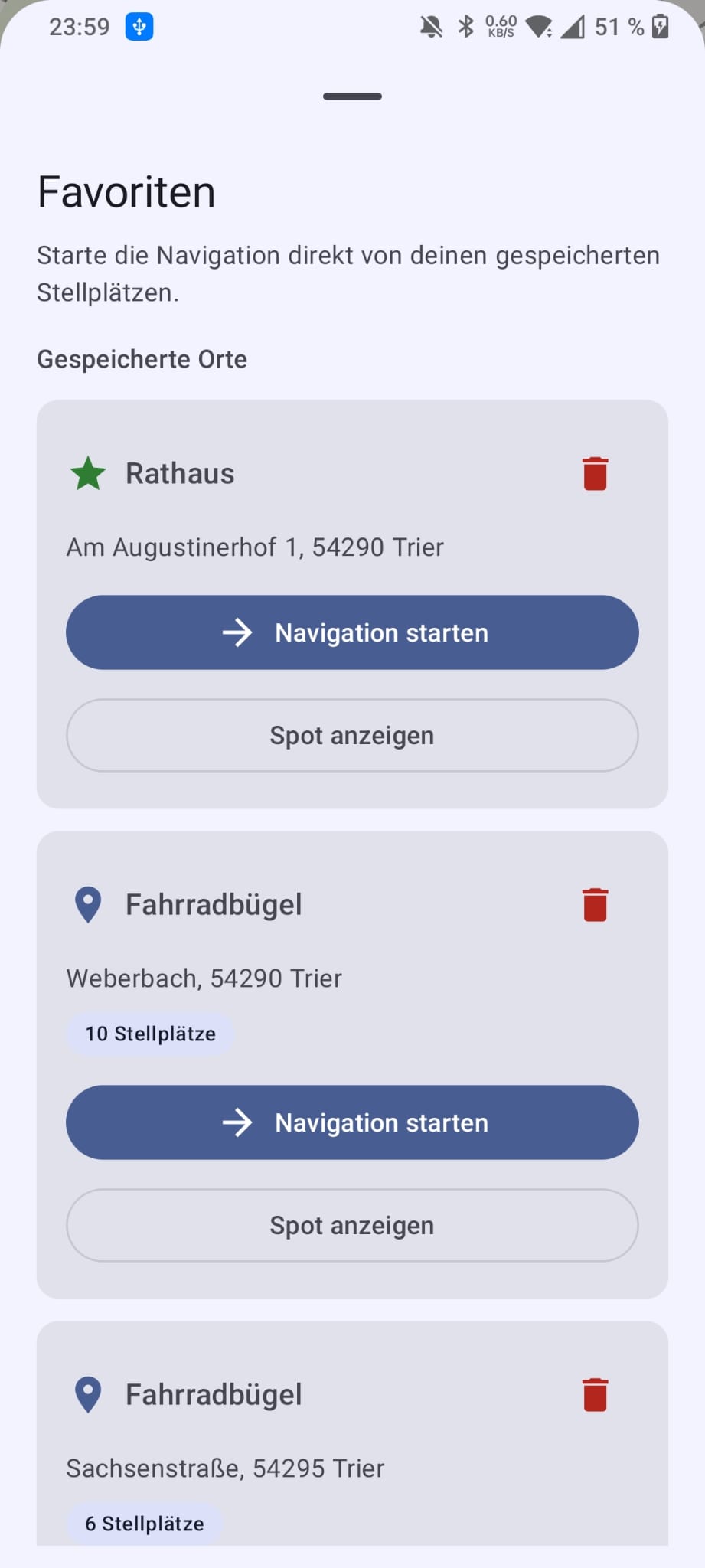
❤️
Favorites
Save the parking spots you use most often and launch navigation directly from the favorites list — even if they are outside the current viewport.
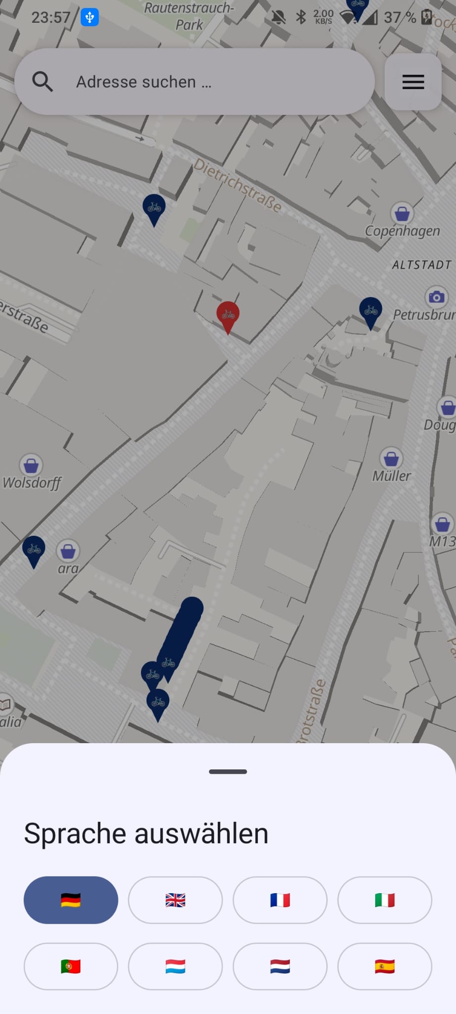
🌐
8 Languages
Switch between German, English, French, Italian, Portuguese, Luxembourgish, Dutch, and Spanish via a flag-based picker — the choice is remembered across app restarts.
🌙
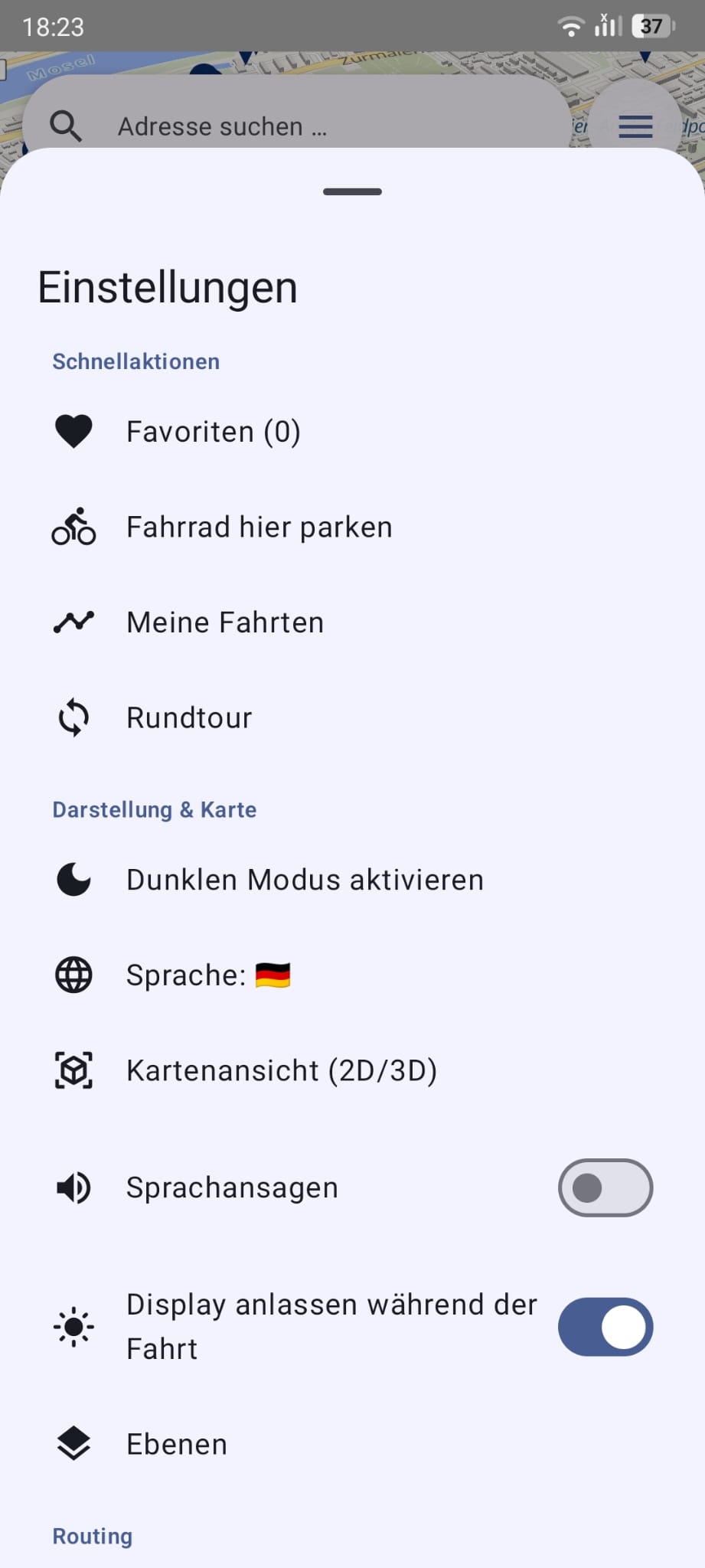
Dark Map Mode
Enable dark mode and the entire map switches to a bundled dark vector-tile style that reuses the same OpenFreeMap tiles — no extra tile provider, with brighter, higher-contrast markers for night use.
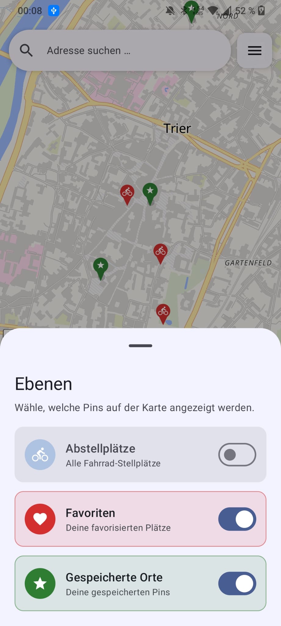
🗂️
Toggle Map Layers
Show or hide pin categories independently — parking spots, favourites, and saved places — via an intuitive layers sheet. The selection persists across restarts.
⭐
Saved Places
Save any tapped location as a named favourite. Saved places appear as persistent green star markers and live in the favourites list with navigate and show-on-map actions.
🧭
In-App Bike Navigation
Calculate bike routes directly inside the app and follow a live route overlay without switching to an external map app.
🏙️
Live 3D Navigation
A Google-Maps-style 3D follow camera (60° pitch, heading-up, speed-dependent zoom) snaps your position onto the route, rotates a heading arrow with your direction of travel, greys out the path behind you, raises 3D buildings, counts down the live remaining distance + ETA, and reroutes automatically when you go off-route.
🧱
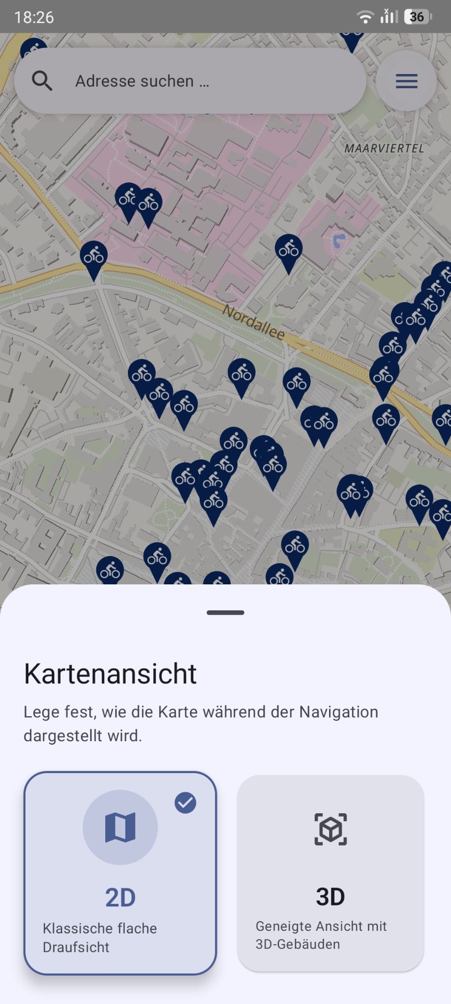
2D / 3D Map View
Pick a flat top-down map or a tilted 3D view with extruded buildings from a sleek segmented selector — the choice is remembered. Active navigation always uses the full 3D camera.
🗺️
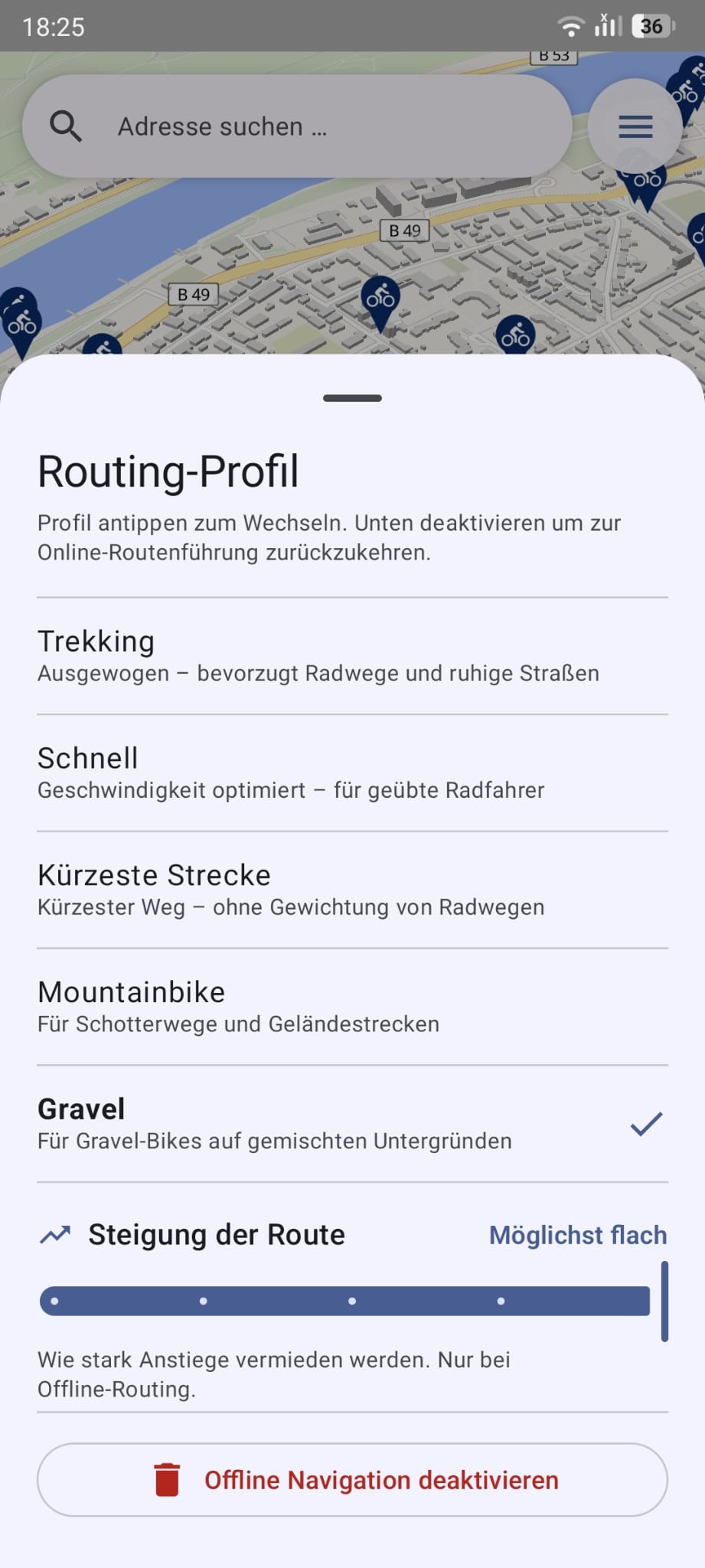
BRouter Offline Routing
Routes calculated entirely on-device via the embedded BRouter engine — no internet needed after the one-time ~200–250 MB segment download. Choose from 5 cycling profiles: Trekking, Fast, Shortest, MTB, and Gravel.
👁️
Navigation Focus
While navigation is active, non-destination markers appear smaller, lighter gray, and more transparent so your target stands out.
📊
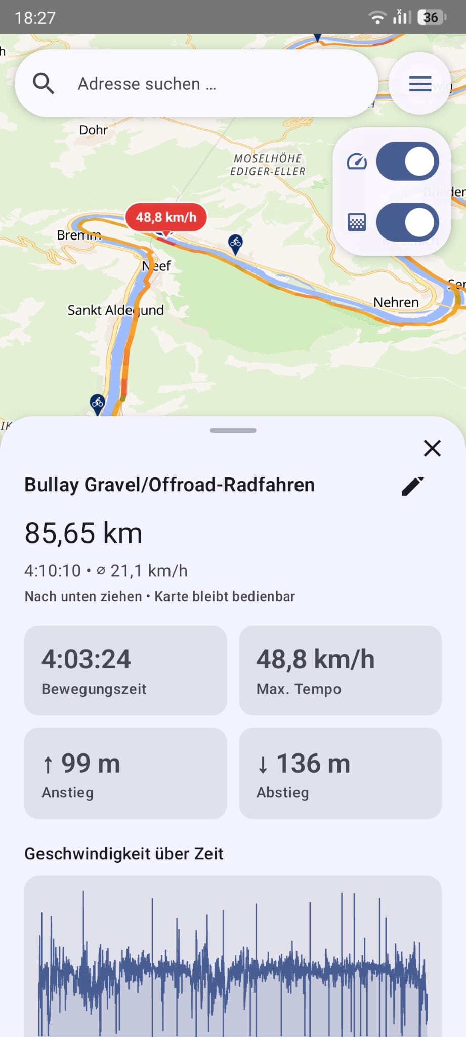
Ride Statistics
Record a ride and the "My rides" timeline leads with a collapsible statistics dashboard: totals (distance, time, elevation), averages, personal records (top speed, longest ride, biggest climb), activity streaks (active days, this week / this month) and fun facts like CO₂ saved vs. a car, calories burned and your share of a lap around the Earth — all computed on-device from your own rides.
🚴
Record Your Rides
Track any ride with live time, distance, speed and elevation plus a speed chart. Recording keeps running in the background with a notification, a Quick Settings tile and a home-screen widget — and your live-location avatar visibly pedals as you ride, planting a foot down when you stop.
🏷️
Named Rides & GPX
Rides are auto-named after the destination ("Round trip – place" for loops), and finishing a manual recording asks for a name suggested from your current location. Export selected rides as GPX — share them or save to a file (combine or one file per ride) — and import GPX tracks back in.
🔥
Ride Heatmap & Ridden Tracks
Turn all your recorded rides into a colour heatmap that reveals where you cycle most, or draw every ride as its own thin, translucent line so frequently used streets read stronger. Both are optional map layers built on-device from your own data.
🗣️
Voice Guidance
Optional spoken turn-by-turn guidance reads the upcoming turns aloud via Text-to-Speech — an early "prepare" cue, a "now" cue right before the turn and an arrival cue — building on the on-screen turn banner. Opt-in and persisted.
🔁
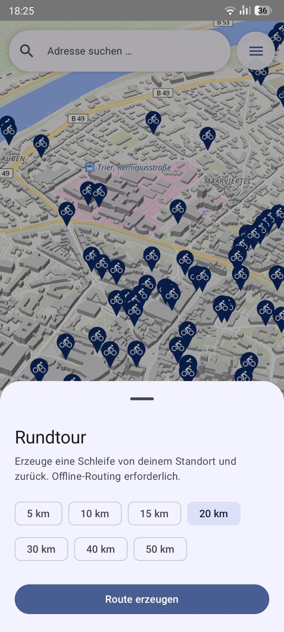
Round-Trip Generator
Pick a target distance (5–50 km) and BRouter builds a circular route that starts and ends right at your position — perfect for a quick loop. Offline routing required.
⛰️
Route Hilliness
A five-step "Route hilliness" slider lets you trade a little distance for less climbing. Each level adds an uphill penalty handed to BRouter and is applied live to point-to-point, on-demand and round-trip routing.
🅿️
Find My Bike
Save where you parked — automatically on navigation arrival or with one tap — and later navigate straight back to it, with the reverse-geocoded address and live distance from your position.
📤
Share Spots & Rides
Share any parking spot, pin, search result or saved place as a universal OpenStreetMap link, or export a recorded ride as a slick "VeloSpot Wrapped" card — your route on a map cutout with your stats — ready for WhatsApp, Telegram & Instagram.